2 Millionen Bücher heute bestellen und morgen im Press & Books oder k kiosk abholen.
Merkliste
Die Merkliste ist leer.
Der Warenkorb ist leer.
Bitte warten - die Druckansicht der Seite wird vorbereitet.
Der Druckdialog öffnet sich, sobald die Seite vollständig geladen wurde.
Sollte die Druckvorschau unvollständig sein, bitte schliessen und "Erneut drucken" wählen.
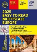
2025 Philip's Easy to Read Multiscale Road Atlas of Europe
ISBN/GTIN

2025 Philip's Easy to Read Multiscale Road Atlas of Europe

(A4 paperback with flaps)
BuchKartoniert, Paperback
Verkaufsrang451inGeokarten_Strassen
CHF27.90

Beschreibung

The latest edition in Philip's best-selling European Atlas range, now in a practical paperback format with place-holder flaps. The 2025 Philip's Easy to Read Multiscale Road Atlas of Europe contains mapping at the best scales for driving in Europe alongside the rules and regulations for every country.
Weitere Beschreibungen

Details

ISBN/GTIN978-1-84907-659-3
ProduktartBuch
EinbandKartoniert, Paperback
ErscheinungslandVereinigtes Königreich
Erscheinungsdatum04.04.2024
Seiten272 Seiten
SpracheEnglisch
Artikel-Nr.60305907
WarengruppeLandkarten
DetailwarengruppeGeokarten_Strassen
Weitere Details

Reihe

Autor

Philip's has been at the forefront of creating maps and atlases since 1834. Whether a local street map or a fact-packed World Atlas, we use the most up-to-date technology, expertise and our global network to ensure our customers have all the information they need.